 | ||||


Fells Reservation
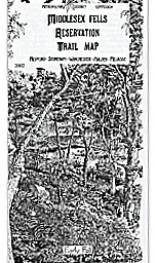
Trail Map
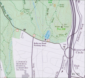
Parking for Wright's Tower visit at Bellevue Pond

A detailed map of the entire Fells Reservation is here.
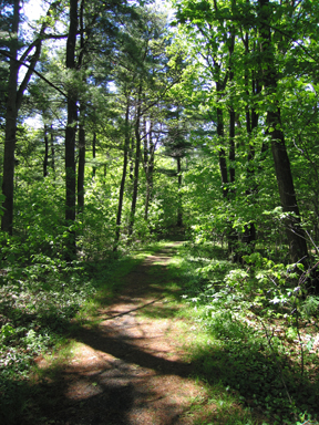
Lawrence Woods Photo: Bryan Hamlin

MAPS

HIKING TRAILS

All the Trails described below are on the Fells Map, which is provided free to members when they join, or it can be purchased (see store list, left).
West of Route 93
Skyline Trail
White blazes. 6.9 miles. Average hiking time: 5 hours.
The Skyline Trail follows the outer perimeter of the western Fells. There are spectacular views of Boston and the surrounding area. Most of the Skyline trail is in wooded landscape, with several steep ascents to rocky outcrops. A difficult hike.
Reservoir Trail
Orange blazes. 5.2 miles. Average hiking time: 3.5 hours.
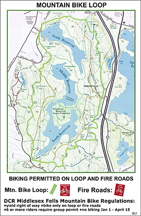
The Reservoir Trail encircles the north, middle and south reservoirs and the open water can be seen from many sites (the reservoirs are for drinking water, so access to them is prohibited). A moderate to difficult hike.
Nature Trail
Pink blazes. 0.9 miles. Average hiking time: 1 hour.
The Nature Trail was developed by Winchester Trails (sponsored by the Winchester School Department and Conservation Commission). This organization has a nature pamphlet and a Teacher's Manual describing plants, animals, insects and geology at 8 trail stations. An easy trail.
Dark Hollow Pond Trail
Yellow blazes. 1 mile. Average hiking time: 1.5 hours.
This Trail skirts the eastern slope of Bear Hill and ends at the rocky edges of Dark Hollow Pond. An easy to moderate hike.
Bear Hill Trail
Blue blazes. 0.2 miles. From the intersection with the Skyline: 15 minutes (via the Skyline Trail north from Sheepfold parking lot: 1 hour).
Accessed from the Skyline trail this trail ascends through the woods to the base of Bear Hill Tower. You may climb the tower for scenic views. An easy hike.
Cross Fells Trail
Blue blazes. 4.5 miles. Average hiking time: 5 hours one way.
Beginning in the western Fells near the Medford High School, the Cross Fells Trail gives a good sampling of the features of the Reservation, from wetlands at Whitmore Brook to open water at Quarter Mile Pond in the eastern Fells, to views at Cairn Hill. Use caution crossing South Border Road, Route 28, Woodland Road and the Fellsway. A difficult hike.
East of Route 93
Crystal Spring Trail
Red blazes. 1.4 miles. Average hiking time: 1.5 hours.
Skirting the edge of a wetland ail ascends Whip and Wamoset Hills and passes close to Crystal Spring. The trail connects to Virginia Wood Trail on the south side of Pond Street (use caution crossing). A moderate hike.
Virginia Wood Trail
Pink blazes. 0.8 miles. Average hiking time: 1 hour.
This trail traverses Virginia Wood. One of the first parcels of private land given for public conservation purposes. The wood is also the site of the old mill town Haywardville (see next trail description). Virginia Wood Trail connects to the Rock Circuit Trail. An easy to moderate hike.
Spot Pond Brook Archaeological District Self Guided Trail
Yellow blazes. 0.8 miles. Average hiking time: 1 hour.
The trail is marked one way (beginning at the Recreation Headquarters) for use with the self-guided trail brochure, describing 150 years of water powered industry. An easy trail. Brochures may be purchased at headquarters.
Rock Circuit Trail
White blazes. 3.7 miles. Average hiking time: 4.5 hours.
Much of the trail traverses rocky outcrops in this corner of the park, providing a variety of scenic views.
Rock Circuit Connector
Orange blazes. 0.6 miles.
Allows hikers to cut the Rock Circuit Trail in half. It runs between gate #51 of the Fellsway East and Rock Circuit Trail.
Descriptions of Middlesex Fells plants and animals and the geological and cultural history are on the back of the Trail Map.
Maps of the Reservation are free with Membership. Non-members may order a map by sending a $6.00 check or money order to: Friends of the Fells, PO Box 478, Stoneham, MA, 02180. Don't forget your address!
In a hurry? Maps may be available at the following retail stores that have carried our maps in the past. Check with them to see if they have maps in stock.
AMC Bookstore - 5 Joy Street, Beacon Hill, Boston, 617/523-063
Book Ends - 559 Main St., Winchester Center, Winchester, 781/721-5933
The Book Oasis - 311 Main St., Stoneham, 781/438-0077
The Book Rack - 13 Medford St., Arlington Center, Arlington, 781/646-2665
Botume House Visitor Center, Fells Reservation, 4 Woodland Road, Stoneham, 781-662-5214
Globe Corner Bookstore - 90 Mt. Auburn St., Harvard Square, Cambridge, 617/497-6277
Porter Square Books - Porter Sq. Shopping Center, Cambridge, 617/491-2220
RE.I. - 279 Salem St. (Rt. 128 Exit 40), Reading, 781/944-5103
Carriage Road, east shore of Spot Pond

 | ||||